
Musiri region has its own historical significance – the temples, the antiquities unearthed, the monuments spread over, inscriptions found at the various places of Musiri region reflecting the history and culture and of the district. Moreover, the unique social composition of Musiri region, augment the importance of the Musiri region in a historical perspective.
The antiquity of Musiri region goes back into the Neolithic Age and Megalithic Age. In the early historic times, this area was ruled by the Pallavas, Cholas, Pandyas and Vijayanagar Emperors. Later, the Palayam chiefs of Thuraiyur and Mittah of Kattuputhur ruled this area.
An inscription of Rajaraja III (1220 AD) in Musiri Periyavaikkal refers to the construction of a stone sluice of tbe Karikala Cbola Peraru at Musiri (முசிரி) alias Mummudicbolapettai.
The name Musiri is derived from the Tamil word ‘musiram’ (முசிரம்), which means liberality or courteousness. There is also an other word called ‘Musiran’ which means unbounded liberty. Hence the Tamil letter, (ர) Ra and Ru (று) is closure to the meaning of Musiri, is gifted land or more courteousness persons living in this village. So the name Musiri is used in all inscriptions of this region.”” But at present in the revenue records the name is written as Musiri (முசிறி).
Musiri is a municipality in the Tiruchirappalli district in the Indian state of Tamil Nadu. Tiruchirappalli district is located in the Cauvery River in Tamil Nadu, India. The main town in Tiruchirappalli District is the City of Tiruchirappalli, also known as Trichy. During the British Raj, Tiruchirappalli was known as Trichinopoly, and was a district of the Madras Presidency; it was renamed upon India’s declaration of independence in 1947. The district is divided into two unequal portions by the river Cauvery. The two territorial divisions are traditionally called Nirambam and Kadarambam.
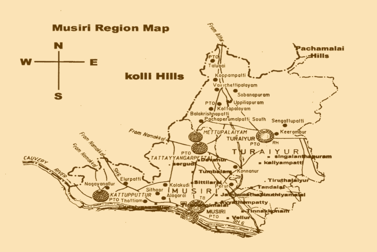
Musiri is located at 10°57′ latitude 78°30′ longitude.’ It has an average elevation of 82 metres (269 feet). It is situated on the North bank of Cauvery river 40 kms, North West of Tiruchirappallli and 45 kms, East of Namakkal. The Musiri region comprised Thuraiyur Taluk, Musiri Taluk and Thottiyam Taluk.
The Soil of the Musiri Region has been arranged in three main clauses, namely the alluvial, the regur or black and the red. In Musiri region, the different type of soils prevailing as follows:
The Alluvial soil – 3%
The Regur soil- 29%
The Red soil – 68%”
A portion of the Musiri taluk lying along the Cauvery River possesses most fertile soil and excellent means of irrigation. The North of the valley of the Cauvery and South of the Pachamalai hills is very uniform in character. The soil is black in the hollows, and red on the higher levels and in the neighbourhood of the hills.

River Cauvery
Cauvery is the life-stream of Tamil Nadu and rises from Brahmagiri and in the hills of Coorg in Karnataka, which is part of the larger Western Ghats. Cauvery’s general course is a South Easterly direction. After traversing hundreds of kilometres the river joins the Bay of Bengal at Kaveripattinam.
In Musiri region the principal sources of irrigation are the Cauvery. The portion of the Musiri region is lying by the Cauvery River, possesses a most fertile soil and excellent means of irrigation. North of the Musiri region is dry Land and there is no Cauvery water for irrigation.
The Aiyar River
The Aiyar River rises in the gorge which separates the Kollimalai from Pachchamalai and receiving numerous tributaries from both ranges of hills, falls into the Cauvery not far from the head of Srirangam island after a short course of about 30 miles through the Musiri taluk.The most important of its tributaries is the Thalugai. The Aiyar, unlike most of the smaller rivers in this district, receives (from the slopes of the Pachaimalais) a considerable supply during the south-west monsoon.
Thalugai River
It is originated from the North West of Kollimalai and tributary of Aiyar. The Thalugai River in Musiri region receives a considerable supply during the South-West monsoon.
The Karaipottanar River
The Karaipottanar (also called Karuvattar) is a small stream rising in the Kollimalai and emptying itself, after a short course through the Namakkal and Musiri taluks, into the Cauvery.
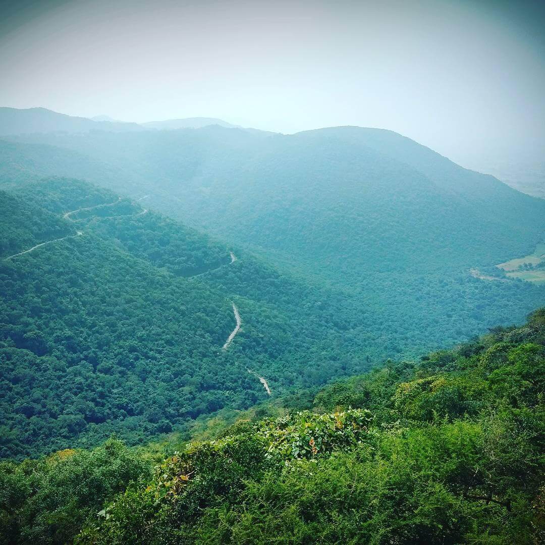
Kollimalai
The Kollimalai range spreads into Namakkal and Attur taluks of Salem district between 11°10-11°27 N latitude and 78° 18-78° 30E longitudes. The hill rises abruptly from the otherwise plain surrounding and has the appearance of a flat-topped mass of mountain. The upper reaches are cut with deep and narrow valleys. The hill rises to an approximate height of 1219 plus metre.
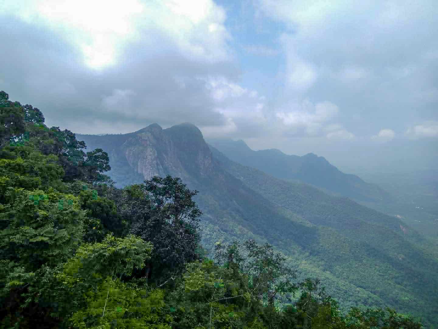
Pachchamalai
Pachchamalai borders the Tiruchirappalli – Salem districts and spreads in the Musiri- Perambalur taluks of Tiruchirappalli and Attur and Salem taluks of Salem district. The range is about 32 kms long having the shape of an hour- glass. The Western slope is steeper than the opposite one and attains a height of nearly 760 metre.
Thalamalai
In the Musiri region there are also scattered, throughout the district, isolated hills here and there, the most striking being the ‘Thalamalai’ in the Musiri taluk, which rises abruptly to a very considerable elevation.
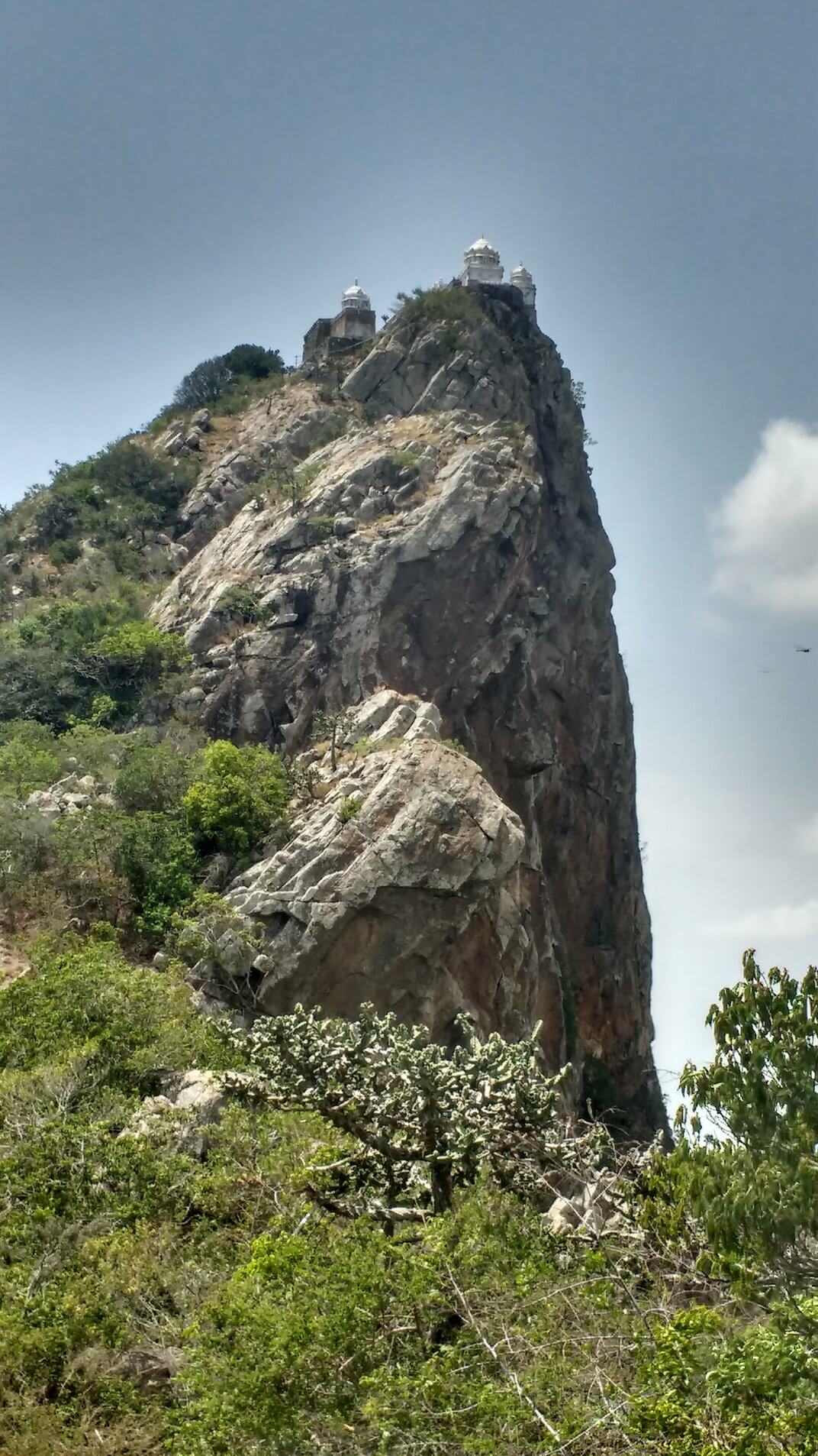
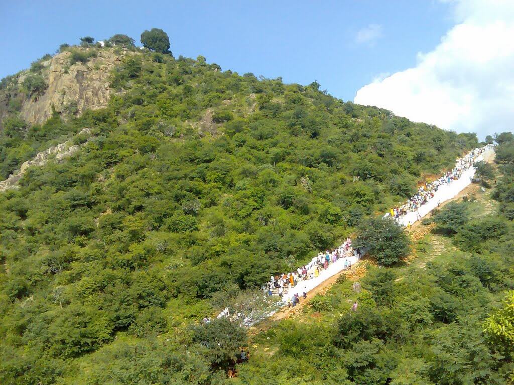
Thiruvengimalai or Thiruingoimalai
Thiruvengi hill is situated about 6 kms West of Musiri. The Siva temple is situated on a hill of 900 feet height. From the Southern part of this hill, one has to climb a plight of 500 steps, well illuminated and with drinking water facilities for the devotees. The width of this hill is 4.5 kms. This place is also known as Thiruvengimalai
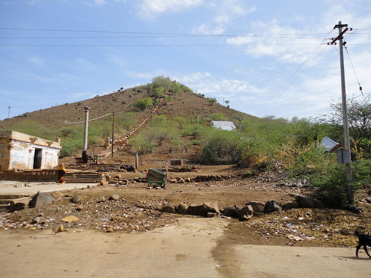
Perumalmalai
There is a small hill 5 kms away from Thuraiyur in Musiri region called Perumalmalai and is about 2000 feet high. It covers full of forest and on the top of the hill.

This will close in 0 seconds